Photo Trip at Sharp Peak - Conquering the Sharpest Summit in Hong Kong
EOS 70D • EF-S 18-135mm f/3.5-5.6 IS • f/8 • 1/2500 • ISO 100
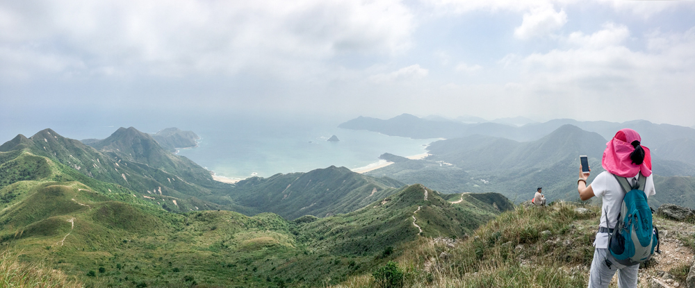
A panoramic view composed of three images
A panoramic view composed of three images
The precipitous Castle Peak, High Junk Peak and Sharp Peak are collectively known as the “Three Sharp Summits in Hong Kong”. Towering 468m above the lowlands, Sharp Peak is the highest one among the three, and is regarded as the sharpest summit in Hong Kong due to its steep slopes and being at a higher vantage point overlooking other hills in the Sai Kung Peninsula. Because of the challenging slopes, as well as the 360-degree unobstructed view from the summit, it is on the conquer list for many hikers and photo lovers alike.
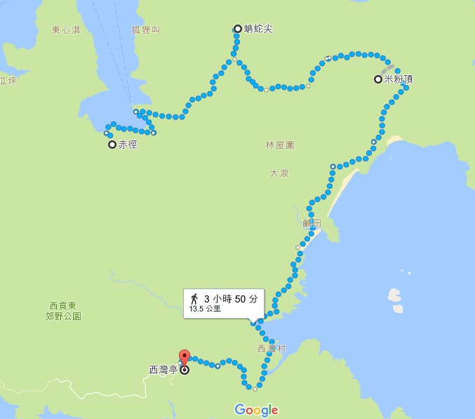
There are a number of trails to get to Sharp Peak. The relatively easy route is to take a ferry at Wong Shek Pier to Chek Keng, go uphill along MacLehose Section 2 and ascend along Nam She Tsim path to the summit. Take the same route back on your return. This route is rugged and challenging and since you have to walk on crushed stones both the way up and down, only experienced hikers who are physically strong are recommended to go.
There are a number of trails to get to Sharp Peak. The relatively easy route is to take a ferry at Wong Shek Pier to Chek Keng, go uphill along MacLehose Section 2 and ascend along Nam She Tsim path to the summit. Take the same route back on your return. This route is rugged and challenging and since you have to walk on crushed stones both the way up and down, only experienced hikers who are physically strong are recommended to go.
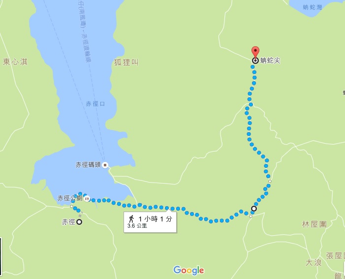
Route map for reference. Source: Google Map
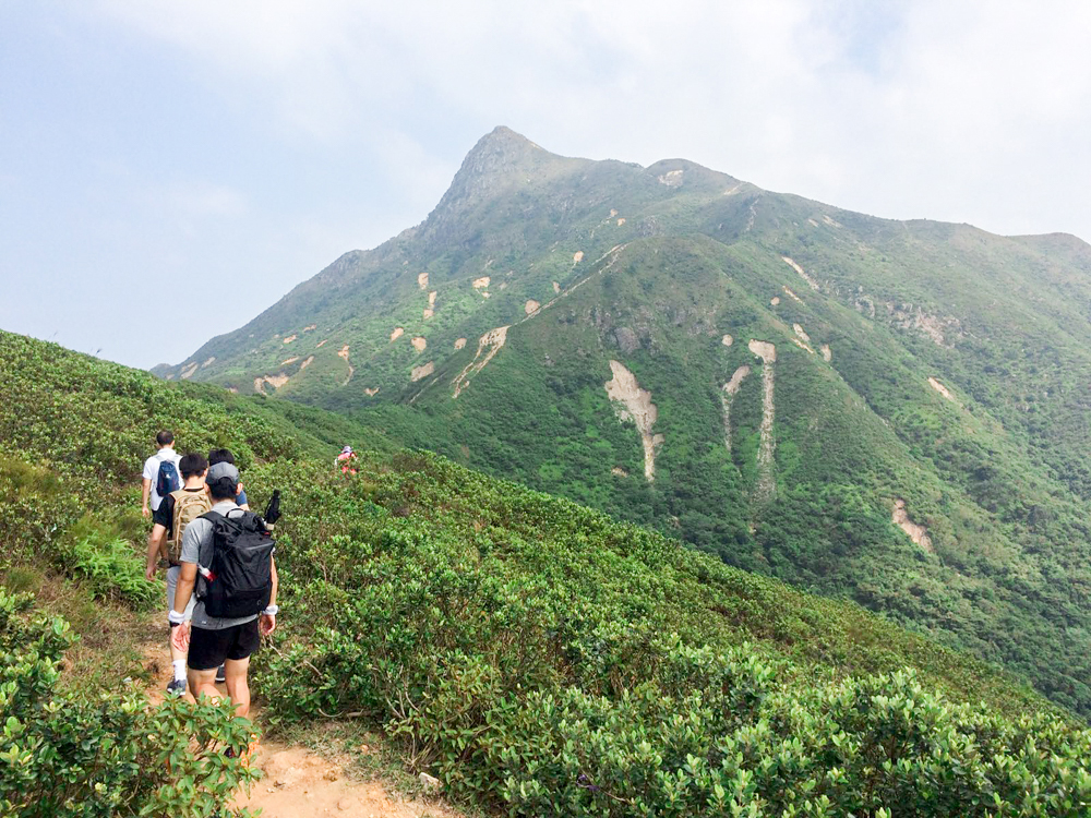
It only takes about 1.5 hours to reach the summit from the starting point Chek Keng. The paths uphill are easily recognizable and it’s hard to get lost. Just be careful of the fluffy soils on the later half section of Nam She Tsim path after leaving MacLehose Section 2 and pay extra attention on your way down. You are advised to wear a pair of gloves to help you climb with both legs and hands engaged.
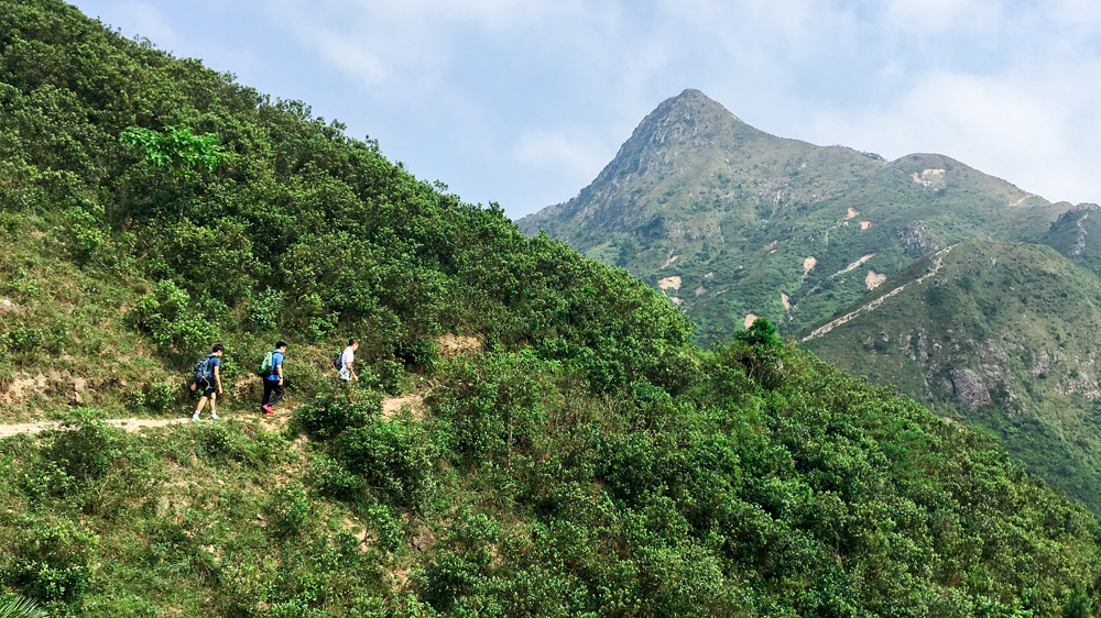
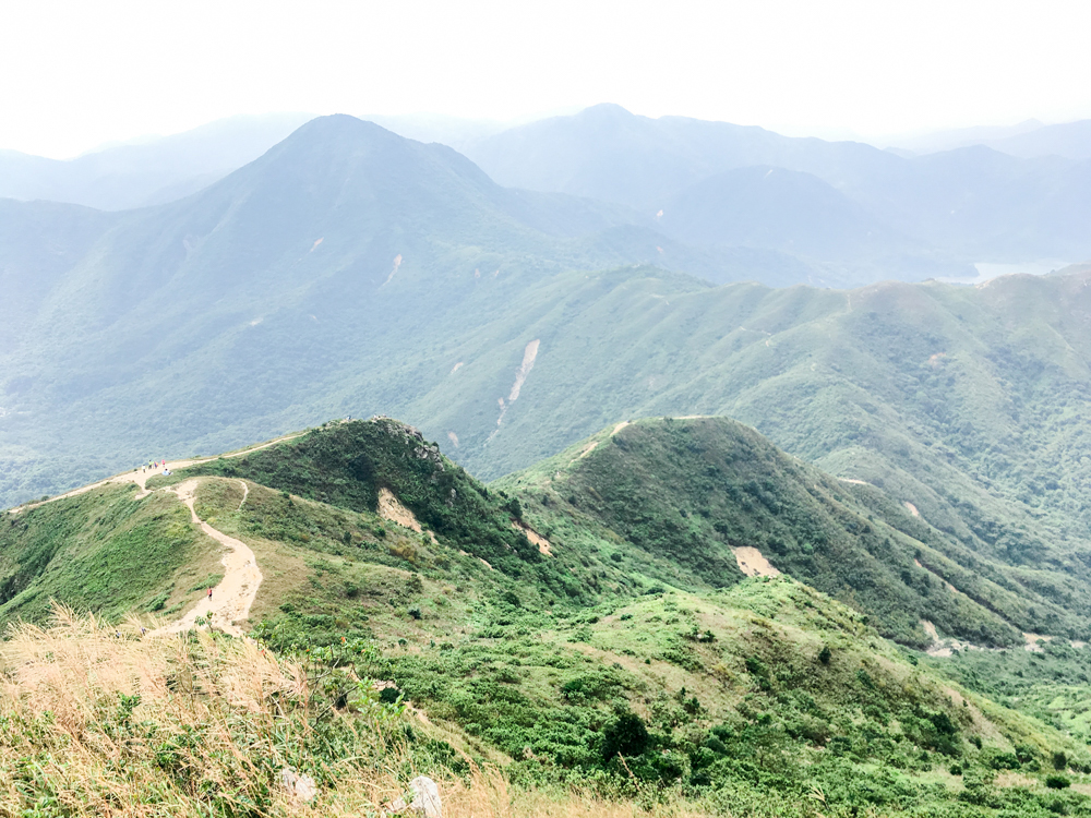
The summit comes into view shortly after leaving MacLehose Section 2 and setting foot on Nam She Tsim path
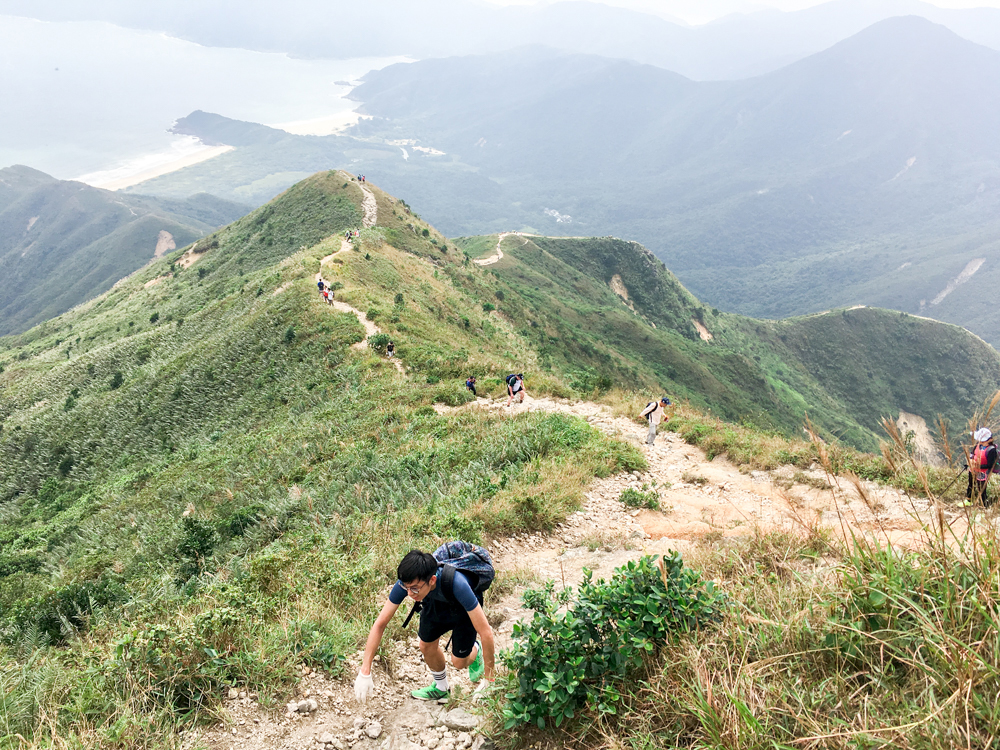
Climb up to the summit with both your legs and hands engaged
If you have the strength and time (in total 8 hours including rest time), you can descend to Mai Fan Teng and walk all the way to Tung Wan, Tai Wan, Ham Tin Wan and Sai Wan and finally exit at Sai Wan Pavilion. This enables you to enjoy the 5 spectacular sceneries (1 sharp summit and 4 bays) in Sai Kung on one visit!
Route map for reference. Source: Google Map
EOS 70D • EF-S 18-135mm f/3.5-5.6 IS • f/8 • 1/1600 • ISO 100
A panoramic view composed of three images
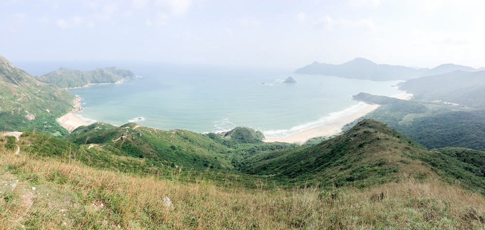
Stunning views of Tung Wan, Tai Wan and Ham Tin Wan (from left to right) from the summit
A panoramic view composed of three images
Stunning views of Tung Wan, Tai Wan and Ham Tin Wan (from left to right) from the summit
A look back at Chek Keng at the summit
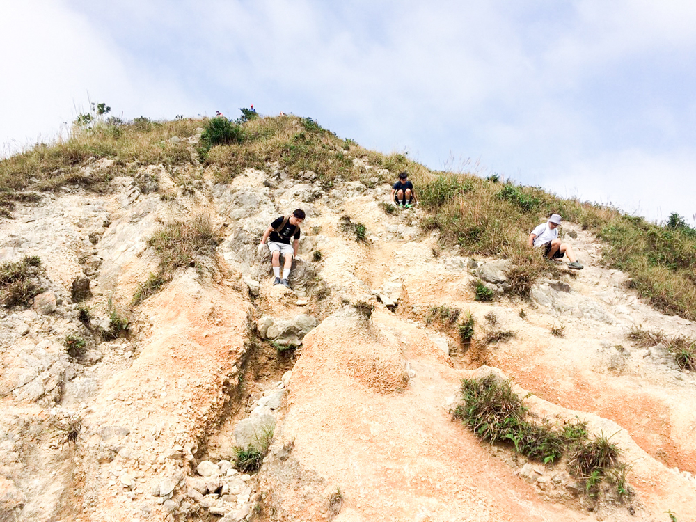
It is particularly dangerous when descending from the summit. You may have to sit down and proceed slowly. So wear the right hiking outfit to prevent slip and fall injuries
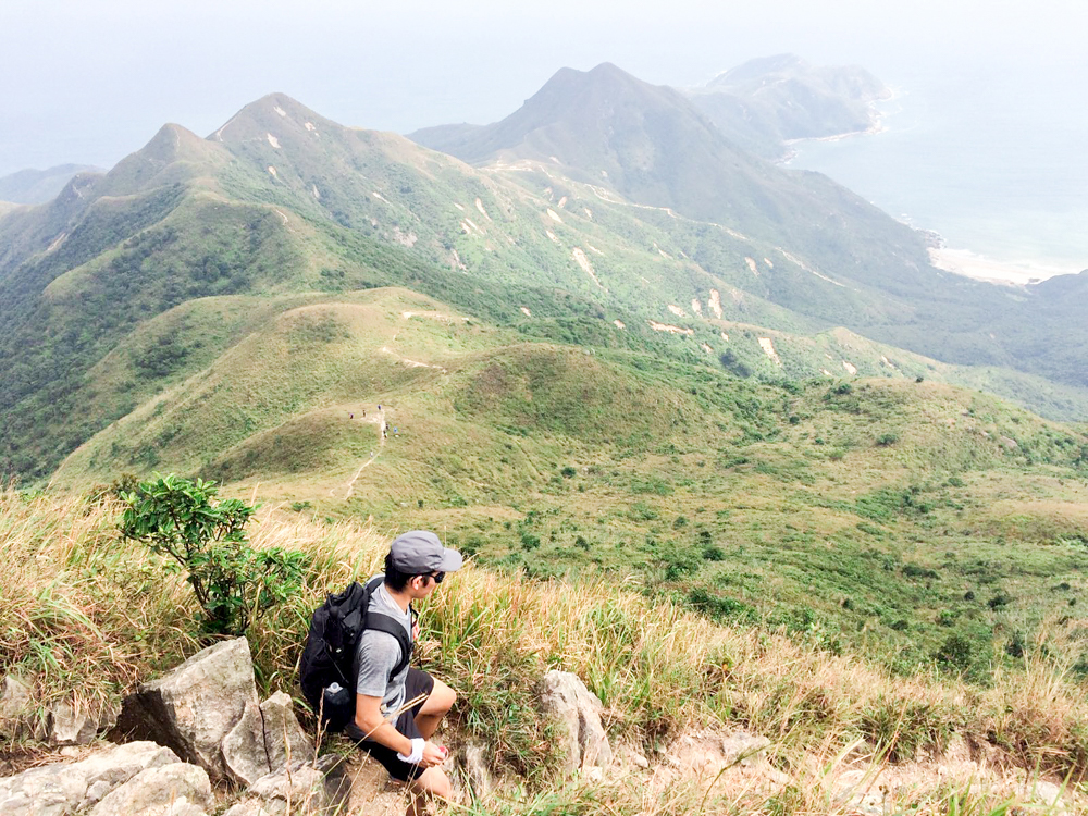
The protruding land on the far end is Cheung Tsui – another challenging route for hiking enthusiasts
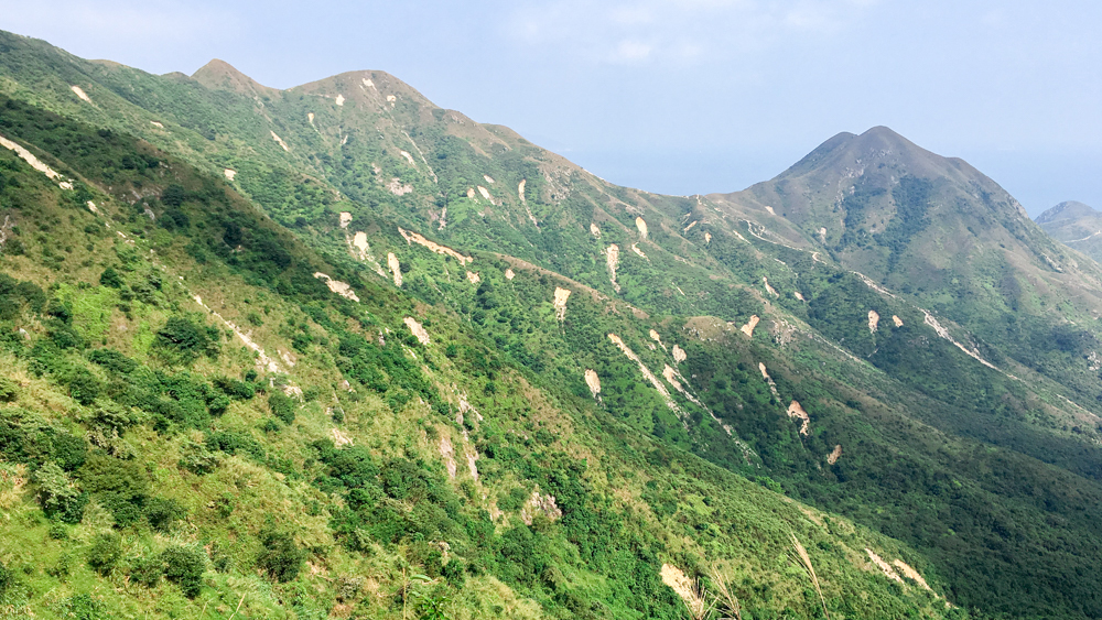
Small-scale landslides can be seen across the summits in Sai Kung after a heavy rain
Although challenging and hard, the sweeping view from the summit of Sharp Peak is worth it. Conquer this peak with your hiker friends and feel the satisfaction yourself!
Related Articles

The precipitous High Junk Peak, Sharp Peak and Castle Peak are known as the “Three Sharp Summits in Hong Kong” by hikers. Towering 344m above the lowlands, High Junk Peak offers unobstructed views of Clear Water Bay and Tseung Kwan O. It is easily accessible by public transportation and less challenging than the other two peaks, making it a good weekend destination for hiking and photography.