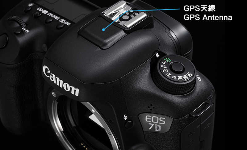
With nature and outdoor photography in mind, EOS 7D Mark II is designed to feature a built-in GPS (Global Positioning System) function, which users can geotag images and videos with ease. This is a convenience feature to facilitate images organization by shooting location and also provide more completed information for future reviews. The GPS antenna of EOS 7D Mark II is located under the cover in front of the hotshoe. Apart from the United States' GPS satellite system, the Russia's GLONASS and Japan's Quasi-zenith Satellite System MICHIBIKI are also supported for the first time. These can provide users with improved positioning precision, fewer locations that cannot be positioned, a higher percentage of being able to record elevation (four or more acquired satellites are necessary) and higher percentage of being able to synchronize time (five or more acquired satellites are necessary) .
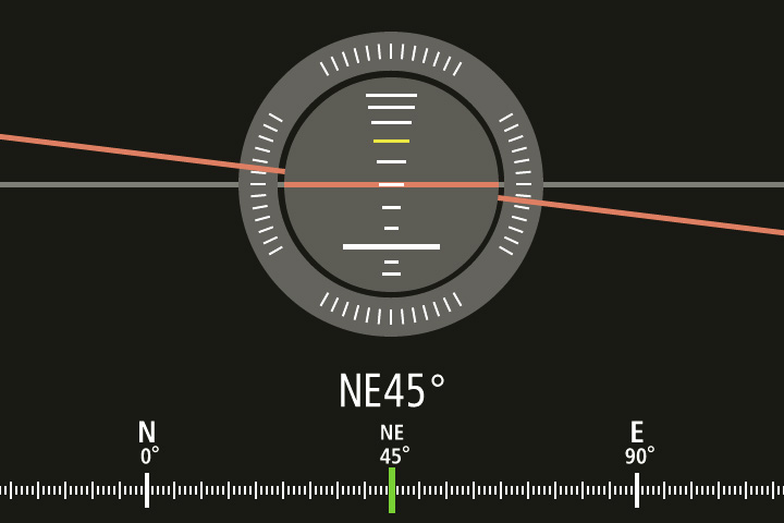
In addition to GPS, EOS 7D Mark II is the first EOS Digital SLR camera featuring a built-in electronic compass. Shooting direction is calculated with triaxial geomagnetic sensor and triaxial acceleration sensor inside the camera and appended to EXIF of images.
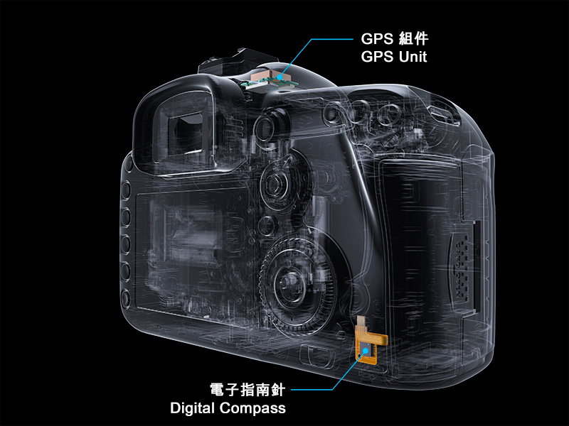
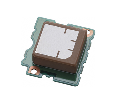
GPS Unit
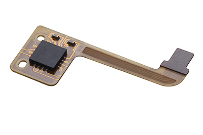
Digital Compass Unit
Geotagging Images and Videos*
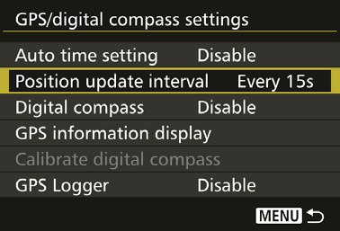
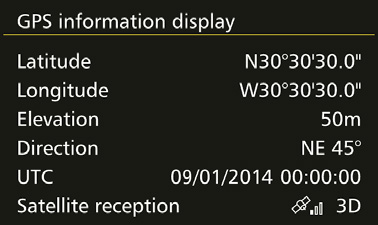
Once activated, the integrated GPS of EOS 7D Mark II takes around 30-60 seconds to acquire signals from GPS satellites. Once the <GPS> icon on the top LCD panel is constantly displayed, the following geotag information will be add to images and videos* taken automatically:
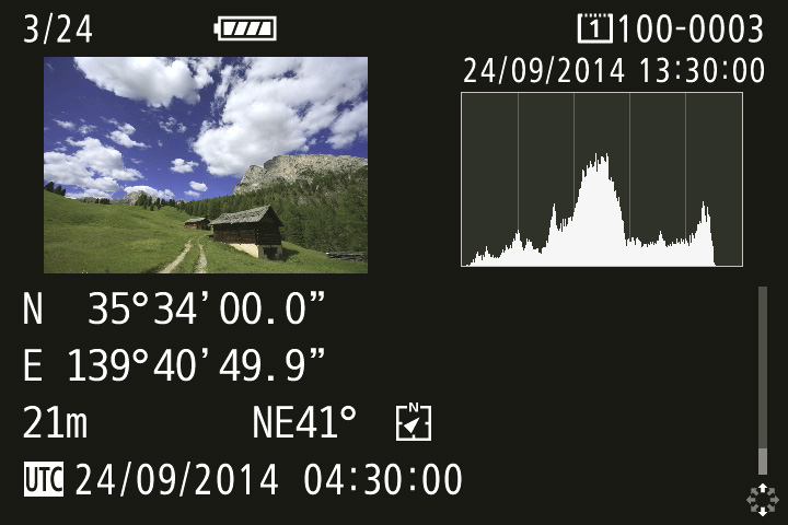
- Altitude
- UTC (Coordinated Universal Time)
- Satellite reception conditions
Enabling Electronic Compass
After enabling the digital compass, camera shooting direction can be amended to images' EXIF in addition to geotag information. When reviewing images with geotag information and shooting direction in Map Utility, the shooting direction will be displayed on the map.
Display of shooting information on LCD Monitor
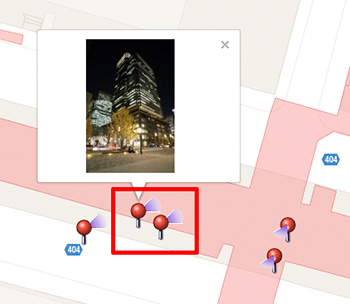
Display of shooting direction in Map Utility
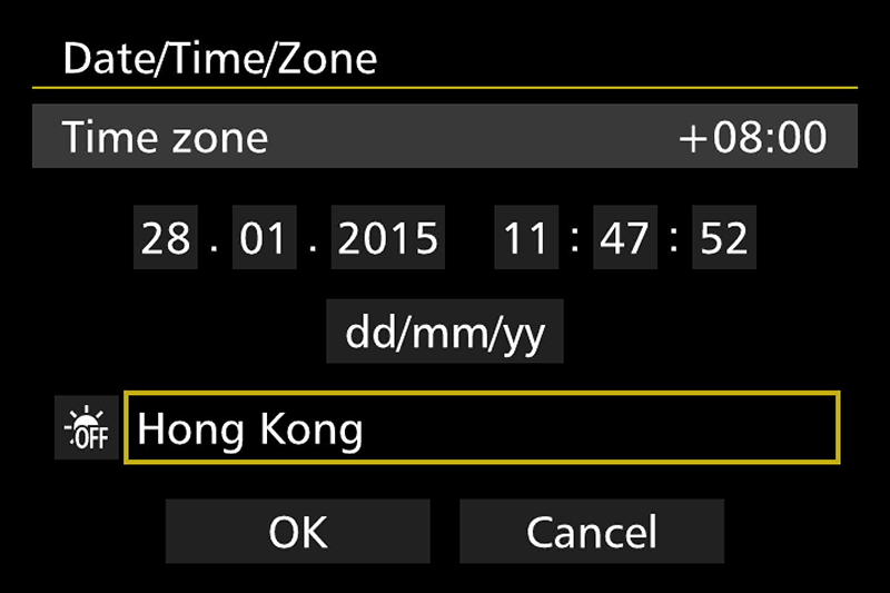
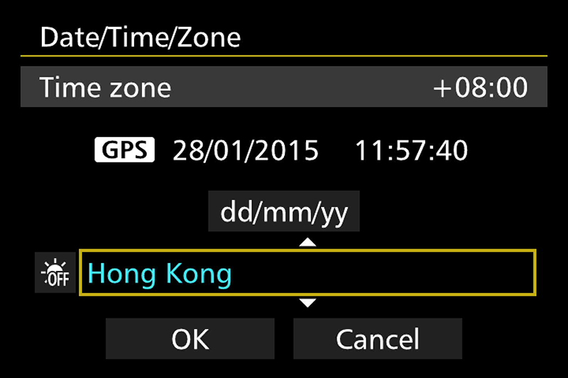
Auto Time Setting with internal GPS
Apart from replying on your watch or clock to set the camera's internal clock, EOS 7D Mark II users can synchronize the camera's clock to UTC standard time using GPS, with margin of error within +/1 second. You can also set the camera to update time automatically each time GPS signal is received.
| Tips of Use |
1. When <GPS> icon on camera's top LCD panel blinks, signal is not yet acquired. When <GPS> icon is constantly displayed, signal has been acquired; images and videos* will be geotagged. |